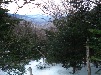
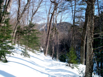
I went to New Hampshire this past weekend for a little late winter hiking. I arrived shortly after noon Thursday and quickly made my way to the trail, climbing up the Nineteen Mile Brook trail from Pinkham Notch to Carter Notch, a distance of 3.8 miles. The picture above shows the view back down the trail towards Pinkham Notch.
This hike is usually doable in about two and a half hours, given the 1,900 foot elevation gain. But with all the snow, it took me about four hours. Maybe being an out-of-shape flatlander also had something to do with my poky pace.
I arrived at the
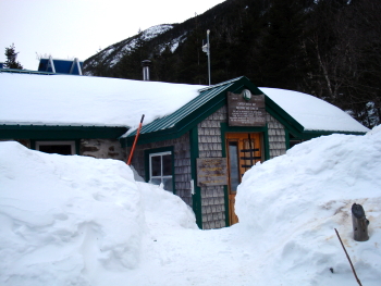
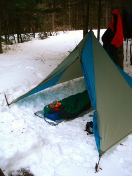
Carter Notch Hut about an hour before dark and found four other hikers there for the night. Up in the notch, the snow easily exceeded six feet in depth.
The next morning, I was going to head off to Imp Shelter, about seven and a half miles down the Carter Moriah Range. As I was leaving, I was was joined by three of the other four hikers from the hut, all of whom were also planning to climb Carter Dome. The hike up the Dome from the south is a steep, icy pitch and two of the hikers joining me on the climb had no traction for their boots. The third had crampons, but he was a woefully unprepared and overly enthusiastic young man with a fondness for the opportunity to use his ice ax. Needless to say, all three of them made me terribly nervous as we climbed. I had to repeatedly remind the enthusiastic young man that is is not a good idea to climb directly below another hiker on a steep pitch. If I would have lost my footing, I would have taken him down the slide with me... not to mention the 12 crampon points on the bottom of each foot.
Thankfully, we all made it to the top of the steep pitch safely.
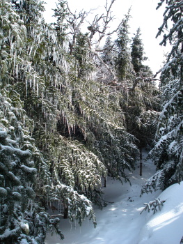
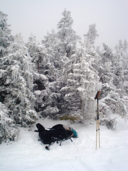
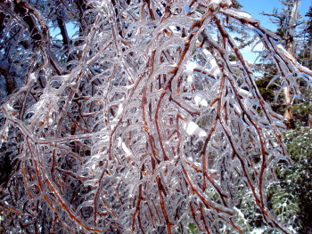
From there, we continued our way through a woods that was increasingly covered with ice from the previous weekend's rain storm on the summits. The ice was magical, as were all the fresh pine martin tracks crisscrossing the trail.
Yet the ice on the trees, combined with the six-foot deep snow, made the hiking more like following a hobbit trail through the tree top branches. It made the hiking really slow going. Finally, by noon, we were on the top of Carter Dome.
An hour later we climbed the summit of Mount Hight, where we had lunch. At that point, we had been hiking for three and a half hours and hadn't even covered three miles. The steep climb and the bushwhack through the tree tops slowed me down greatly and had me reconsidering my plans to hike to Imp Shelter, four miles of which was likely to be more bushwhack through the treetops while hiking solo at elevation. I thought the more prudent thing to do would be to descend and to make the hike in another winter when the snowpack was not so heavy, or when I have a companion or two to help break trail.
So I ascended with the others, down through Zeta Pass, and out to Pinkham Notch. I arrived at the car a little after 4:00pm, this time making four plus miles in two and a half hours.
That night I camped at Sugarloaf Campground II down by Zeeland Road. I got in just early enough to pitch my tent and make my dinner before dark. The night was mild, and temperatures inside the tent never dipped low enough to freeze my gear.
I got up early the next morning and headed up to Crawford Notch where I made reservations for the next two night's stays. By 9:00am, I was changed into fresh clothing, repacked, and hiking my way up the Avalon Trail to the Field/Tom notch via the A to Z Trail.
At the notch, I ran into a number of other hikers, including one sanctimonious fellow who lectured me about the importance of wearing snowshoes and not ruining the trail with post-holing. He must not have seen the snowshoes upon which I was sitting.
After the blowhard left, I hiked up to the summit of Mount Tom, which was shrouded in mist and clouds. Given the lack of views, I didn't stay long, returned to the notch, and descended down the west side of the ridge on the A to Z trail towards Zeeland Falls Hut.
Again, the trail was in the treetops and I need to beat back snow covered spruce branches for the next mile and a half. Tedious work!
I arrived at
Zeeland Falls Hut in the late afternoon, rather soaked with sweat and melted snow from the bushwhack. The hut had about two dozen people staying in it (Saturday night), but it was a great crowd of friendly folks.
Sunday morning I was to hike with Tom and Renae from southern New Hampshire. I headed out on the Lend-a-Hand Trail a few minutes before them and said I would wait up for them at the summit of Mount Hale.
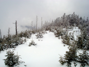
When I got to the summit of Mount Hale, it too was in the clouds. I waited around for forty-five minutes, taking pictures and snacking a bit, but Tom and Renae never showed. So I descended the Hale Brook Trail and walked out Zeeland Road to the highway.
I was going to hitch back up to Crawford Notch (10 miles or so south), but there was already another hitchhiker on the road. Minding my manners, I allowed him his space. But he had a HUGE pack and cross country skis, so car after car passed him by. Finally, forty-five minutes later, one of the other hikers from the hut came out and offered me a ride back up to the notch. We picked up the other guy as well.
That night I stayed at the
Shapleigh Bunk House, which was empty except for one other woman. I ended the trip by taking in the
Brad Washburn photography exhibit in the Highland Center's Thayer Hall.
Overall, it was a good trip. While the skies were not particularly clear, nor the views long, I did get to bag another two 4,000 footers in the winter(Tom and Hale), I met great folks, and I got to wander among the tracks of spruce grouse, snowshoe hare and lynx for a few days.
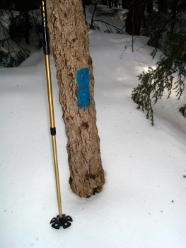 Snow depth at the beginning of Nineteen Mile Trail. Later the blazes would be right by or even below the snow.
View of Carter Dome showing the western slide.
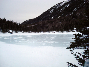
Upper Carter Lake, the water (and trout) source for the hut.
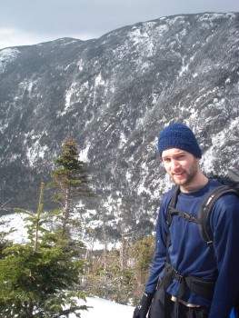
Kyle from Flint (bare-booter) on the shoulder of Carter Dome. The Carter Notch Hut is in the notch below.
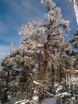
Ice tree on the ascent of Carter Dome.
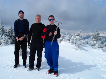
Kyle, his dad Chuck, and the enthusiastic young Chris on the top of Carter Dome.
Birch in ice above Zeta Pass on Mount Hight.
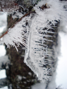
Closeup of rime ice on a wind-bent icicle on Mount Hale.
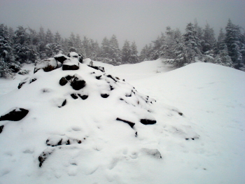
Lonesome summit of Mount Hale.
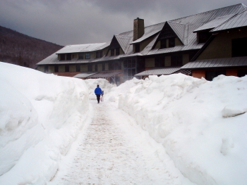
Piles of snow in Crawford Notch.