Showing posts with label walks. Show all posts

Saturday, April 12, 2008

Big Shots

hepatica
Today was too rainy for working in the yard, so I went out and did some maintenance on my adopted section of the North Country Trail in the Rogue River Sate Game Area. The birds didn't seem to mind the rain and were chirping away. I wished I wasn't so busy, I would have liked to watch them.

It was only about 40 degrees, and raining off and on. I had to keep moving to keep warm. So I guess it was good that there were a number of fallen trees across the trail that required me to swing my ax.

Other than the birds, the woods were silent in their wetness. As I swung my ax into a fallen oak, the blade cracked through the woods. Each swing was like a gun shot going off. Crack! Crack! Crack!

Just me, the birds, the dripping rain and the sound of my ax.

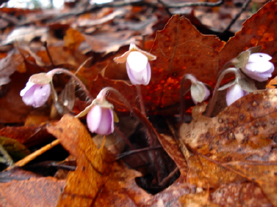
At one point, as I was rummaging through my rucksack, I saw some tiny hepatica pushing up the leaves nearby. I had to look twice. The woods are late coming into spring this year.

Everything was so brown and gray. So when I saw these tiny hepatica closed up from the cold and rain, I was quite pleasantly surprised.

As bold as they were, pushing back last year's oak leaves, I thought they too were big shots. Braving the icy rains to bring forth the promise of spring.

Spring rain and birdsong
in a brown and gray woods.
Soft leaves under my feet.
Sharp ax meets hard oak
like a shot from a gun, cracking
through the woods.
Birds,
dripping rain,
the sound of my ax.

Look! There are some tiny hepatica pushing back last year's oak leaves!

They too are big shots,
braving the the icy rain
the promise of spring.


Thursday, April 10, 2008

Ken's Video

We did a little trail work on the North Country Trail up by Highbanks Lake in Newaygo County this past Saturday. My friend Ken Knight shot this video.


Making a Difference: Building New Trail from Ken Knight on Vimeo

Tuesday, March 18, 2008

New Hampshire

Pinkham
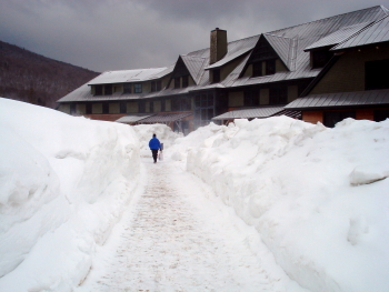
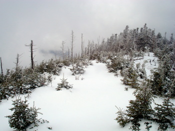
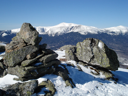
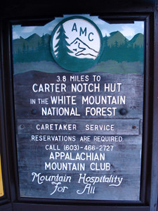
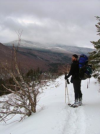
I went to New Hampshire this past weekend for a little late winter hiking. I arrived shortly after noon Thursday and quickly made my way to the trail, climbing up the Nineteen Mile Brook trail from Pinkham Notch to Carter Notch, a distance of 3.8 miles. The picture above shows the view back down the trail towards Pinkham Notch.

This hike is usually doable in about two and a half hours, given the 1,900 foot elevation gain. But with all the snow, it took me about four hours. Maybe being an out-of-shape flatlander also had something to do with my poky pace.

CarterHut
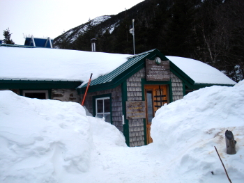
I arrived at the Carter Notch Hut about an hour before dark and found four other hikers there for the night. Up in the notch, the snow easily exceeded six feet in depth.

The next morning, I was going to head off to Imp Shelter, about seven and a half miles down the Carter Moriah Range. As I was leaving, I was was joined by three of the other four hikers from the hut, all of whom were also planning to climb Carter Dome. The hike up the Dome from the south is a steep, icy pitch and two of the hikers joining me on the climb had no traction for their boots. The third had crampons, but he was a woefully unprepared and overly enthusiastic young man with a fondness for the opportunity to use his ice ax. Needless to say, all three of them made me terribly nervous as we climbed. I had to repeatedly remind the enthusiastic young man that is is not a good idea to climb directly below another hiker on a steep pitch. If I would have lost my footing, I would have taken him down the slide with me... not to mention the 12 crampon points on the bottom of each foot.

Thankfully, we all made it to the top of the steep pitch safely.
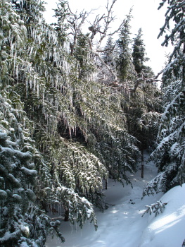
CarterTrailFrom there, we continued our way through a woods that was increasingly covered with ice from the previous weekend's rain storm on the summits. The ice was magical, as were all the fresh pine martin tracks crisscrossing the trail.

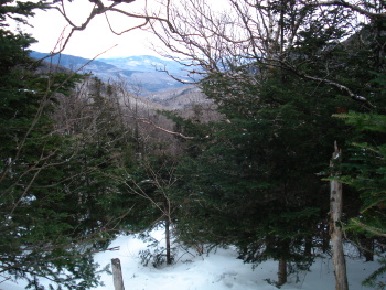
Yet the ice on the trees, combined with the six-foot deep snow, made the hiking more like following a hobbit trail through the tree top branches. It made the hiking really slow going. Finally, by noon, we were on the top of Carter Dome.

An hour later we climbed the summit of Mount Hight, where we had lunch. At that point, we had been hiking for three and a half hours and hadn't even covered three miles. The steep climb and the bushwhack through the tree tops slowed me down greatly and had me reconsidering my plans to hike to Imp Shelter, four miles of which was likely to be more bushwhack through the treetops while hiking solo at elevation. I thought the more prudent thing to do would be to descend and to make the hike in another winter when the snowpack was not so heavy, or when I have a companion or two to help break trail.

So I ascended with the others, down through Zeta Pass, and out to Pinkham Notch. I arrived at the car a little after 4:00pm, this time making four plus miles in two and a half hours.
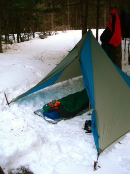
CampThat night I camped at Sugarloaf Campground II down by Zeeland Road. I got in just early enough to pitch my tent and make my dinner before dark. The night was mild, and temperatures inside the tent never dipped low enough to freeze my gear.

I got up early the next morning and headed up to Crawford Notch where I made reservations for the next two night's stays. By 9:00am, I was changed into fresh clothing, repacked, and hiking my way up the Avalon Trail to the Field/Tom notch via the A to Z Trail.

At the notch, I ran into a number of other hikers, including one sanctimonious fellow who lectured me about the importance of wearing snowshoes and not ruining the trail with post-holing. He must not have seen the snowshoes upon which I was sitting.

MtTom
After the blowhard left, I hiked up to the summit of Mount Tom, which was shrouded in mist and clouds. Given the lack of views, I didn't stay long, returned to the notch, and descended down the west side of the ridge on the A to Z trail towards Zeeland Falls Hut.

Again, the trail was in the treetops and I need to beat back snow covered spruce branches for the next mile and a half. Tedious work!

I arrived at Zeeland Falls Hut in the late afternoon, rather soaked with sweat and melted snow from the bushwhack. The hut had about two dozen people staying in it (Saturday night), but it was a great crowd of friendly folks.

Sunday morning I was to hike with Tom and Renae from southern New Hampshire. I headed out on the Lend-a-Hand Trail a few minutes before them and said I would wait up for them at the summit of Mount Hale.
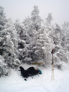
MtHaleTreesWhen I got to the summit of Mount Hale, it too was in the clouds. I waited around for forty-five minutes, taking pictures and snacking a bit, but Tom and Renae never showed. So I descended the Hale Brook Trail and walked out Zeeland Road to the highway.

I was going to hitch back up to Crawford Notch (10 miles or so south), but there was already another hitchhiker on the road. Minding my manners, I allowed him his space. But he had a HUGE pack and cross country skis, so car after car passed him by. Finally, forty-five minutes later, one of the other hikers from the hut came out and offered me a ride back up to the notch. We picked up the other guy as well.

That night I stayed at the Shapleigh Bunk House, which was empty except for one other woman. I ended the trip by taking in the Brad Washburn photography exhibit in the Highland Center's Thayer Hall.

Overall, it was a good trip. While the skies were not particularly clear, nor the views long, I did get to bag another two 4,000 footers in the winter(Tom and Hale), I met great folks, and I got to wander among the tracks of spruce grouse, snowshoe hare and lynx for a few days.
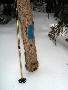
blaze
Snow depth at the beginning of Nineteen Mile Trail. Later the blazes would be right by or even below the snow.
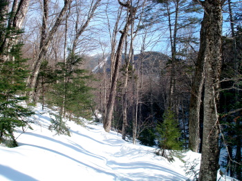

CarterSlide
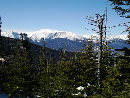
View of Carter Dome showing the western slide.
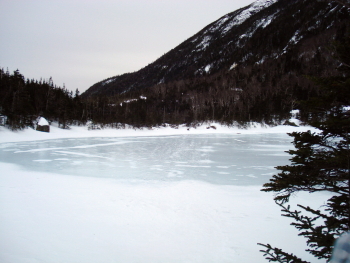

UpperCarterLake
Upper Carter Lake, the water (and trout) source for the hut.
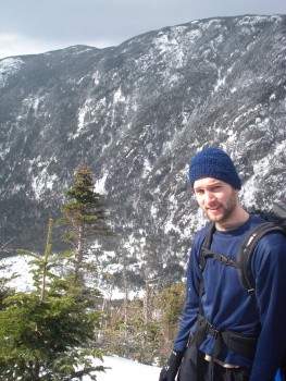

Kyle
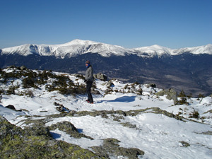
Kyle from Flint (bare-booter) on the shoulder of Carter Dome. The Carter Notch Hut is in the notch below.
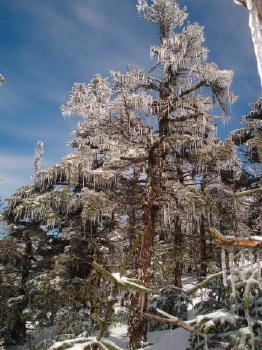

CarterTree
Ice tree on the ascent of Carter Dome.
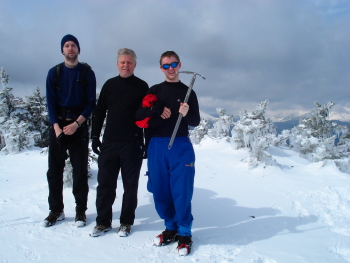

CarterDome
Kyle, his dad Chuck, and the enthusiastic young Chris on the top of Carter Dome.
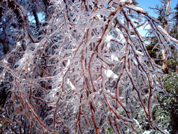

TreeIce
Birch in ice above Zeta Pass on Mount Hight.
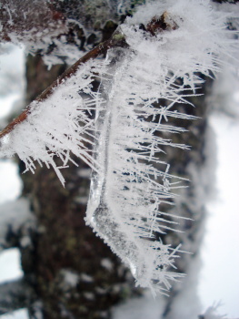

rime
Closeup of rime ice on a wind-bent icicle on Mount Hale.
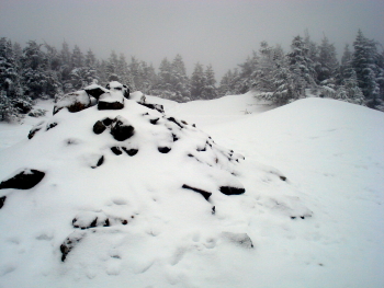

MtHale
Lonesome summit of Mount Hale.


crawford
Piles of snow in Crawford Notch.
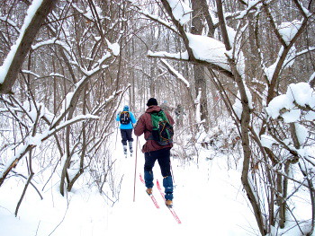
Saturday, January 26, 2008

Cannonsburg Ski

ski_trees080126
Mid-January graced west Michigan with a good amount of snow after an early January melt (which even provided 60-degree temps for a Monday evening walk across town!).

While our beautiful snow is now melting (I'm writing this on a rainy Monday night), we had a good foot and a half of the white stuff on Saturday, and a couple of inches of it were fresh. That was a good thing, because Matt Hahnfeld was leading a cross-country ski outing for the Western Michigan Chapter of the North Country Trail Association at Cannonsburg State Game Area.

It was a good event in the sense that all six who showed up were competent skiers. This allowed us to ski about nine miles in three hours. Temps stayed in the 20's, so conditions were about perfect.

Here's a video of the group (minus me and Hahnfeld) coming down a hill. Some were daring enough to ski right across the footbridge. The first skier is Georgia. Let's just say she's "retired." A real inspiration!


Saturday, January 12, 2008

Top Walks

I was just reading Will Self's column for today and he listed his "favourite winter walks", so I got to thinking about what were my favorite walks of 2007. Here are some of them.

Carter Dome Loop (NH). In February, I had the opportunity to take a 10 mile solo hike and snowshoe up and over Carter Dome in New Hampshire's White Mountains. I blogged about this hike earlier. The most memorable thing about this hike was the brilliant blue sky and the absolute stillness and silence on the top of Mount Hight.

Millennium Park, Chicago (IL). In late winter, early spring, I had to go down to Chicago for a meeting with the folks from EPA Region V. A colleague, Chuck Hoyt, joined me for the trip where we took Amtrak to Chicago and back. There was no time in the morning, so we had to take a cab instead of walking. But after the meeting was done, we had enough time to walk from East Lower Wacker Drive back to the Amtrak Station via Millennium Park. While I have been to Chicago a few times recently, I had not been to this section of Millennium Park since the bean and other public art were installed. If you're ever in Chicago, make sure to check out the Cloud Gate sculpture and the Crown Fountain (photo courtesy of christopherdale).

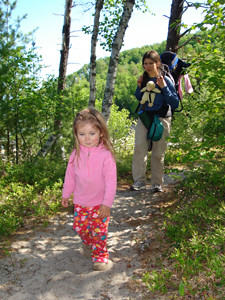
Pictured Rocks National Lake Shore (MI). I blogged about this hike earlier also. Current memories include fields of forget-me-nots, incredible bird song, good company, and of course the fact that this was Abbey's first backpacking trip. Forty-plus miles and three nights out. Not bad for a three-year-old!


Holden Beach
(NC). The memorable walk during this June vacation was down the beach to the south and back. The fact that we overshot our beach house on the walk back by nearly a mile was actually the best part. I enjoyed Julie and Abbey's company as we back-tracked on the road in the dark, peeking into lit-up beach houses full of vacationers. While down on the beach, we chased ghost crabs, walked in shallow tidal pools, and watched the pelicans glide on as the last minutes of daylight waned.

Raven Rocks (NC). A few days after the Holden Beach trek, Julie and I found a nice surprise in Raven Rocks, a state park in North Carolina where old limestone cliffs have been worn away by the Cape Fear River. It was a nice break from driving across the state. Abbey slept for half of the walk and Julie and I got to have a nice, quiet walk in the woods.

Loco Pops in Chapel Hill (NC). This walk was with Johnny and Candace Waken later the same day as the Raven Rocks walk. We walked down East Main Street in Chapel Hill on a hot June night to get us some Loco Pops. While the chile mango and lavender chocolate popsicles were great, it was the company of friends that are not seen nearly enough that made this walk memorable.

Monroe Mall (MI). On the days when I am fortunate enough to take the bus to and from work, I typically transfer so that I can walk the length of Monroe Mall from end to end. The morning walk is nice, with a stop in at Four Friends for coffee, but I particularly enjoy the evening walk as it is less rushed and often imbued with the colors of the evening sky.

To Cathy's House and Back (MI). On Thanksgiving, Julie, Abbey and I walked the little more than three miles to my brother Bill's girlfriend Cathy's house for Thanksgiving dinner. Both the walk there on a sunny, 20 degree afternoon and the walk home on a cold, clear night were memorable. The walk made me wish that more days allowed the time for walking from place to place when in one's home town.

Tuesday, January 08, 2008

Dérive

Those who know me know that I like to walk. I'm not quite sure why I do. If I had to hazard a guess, I would suspect that the act of walking purely has a positive physiological effect on my body, and hence my spirits.

Exercise and deep breaths fire off the dopamine. Without a thought, neurons connect and disconnect. Something totally subconscious happens at the most physical level.

I'm rather addicted to the sensation that comes from a long walk. A couple of hours is good, but walking for days or weeks at a time are certainly better.

It used to be that I liked hiking. Then, I thought that it was being out in the woods that gave me the charge. And while the woods are certainly nice, I've learned that it's not so much a hike in the traditional "drive out to the woods and check out nature" sense that gets me going. It's just the simple act of walking.

Which is good, because of late I've come to not only define myself as a walker, but also as an urbanist. While I grew up in rural-cum-suburban southern New York, my adult years have been spent living close-quartered houses on postage stamp sized lots in a mid-sized, midwestern city. I've grown to love being close to my neighbors (even when they frustrate me), being where I can walk to the store and the letter carrier walks to my front door, and having most modern amenities close enough that I don't spend a huge portion of my waking hours trapped in the confines of a car.

So the two have come together quite a bit during the last ten years of my life, and it's gotten to the point that I don't know which I prefer more... a walk in the woods, or a good trek across town.

When I was up in Glen Arbor, Michigan a few years back, I was digging around in the Cottage Bookshop, an excellent independent bookstore, and I came across Rebecca Solnit's Wanderlust. In this book, Solnit looks at walking from many angles... historical, sociological, philosophical, psychological, political, artistic, and so on.

Reading that book as I wandered the beaches of Sleeping Bear Dunes (walking barefoot may be the best form of walking!), I began really thinking hard for the first time about why it is that I like to walk.

Last week, I picked up Psychogeography, by Will Self. Self has me thinking about walking in new and different ways, and has me wondering if I really do understand why I like walking, and if I really understand what I am experiencing as I walk.

Psychogeography is a term that was interjected into modern thought by French situationist Guy Debord. Debord had a fondness for taking long walks as an act of protest, as a way of intentionally reacting to the modern society around him by making whimsical yet deliberate choices not to follow the conventional route from place to place. The dérive was the term he gave to these long walks where he attempted to refine the relationship between external geography and the internal self.

So now, along with Solnit's tremendous amount of information about walking, I have Self's commentary and Debord's half-baked theories rattling about in my head. All this gives a guy a lot to think about as he walks around town.

Last night I took a good long walk with my friend Eric, from Creston through downtown and into Heartside. It was a rainy, uniquely 60 degree January night. The company and the landscape ensured that my walk was interesting, but so did the simple act of wondering about the meaning of the walk itself.

Wednesday, January 02, 2008

To Your Health!

The change of the years always brings new things. Resolutions, the post-holiday season, and new digits that have to be hardwired into the brain before writing checks.

For us, this new year brought new snow, a new tradition, and friendships both new and renewed. To celebrate this rather arbitrary holiday, Julie, Abbey and I joined ten other friends at a cabin in the Waterloo-Pinckney State Recreation Area. We typically gather with this group earlier in December, but the cabin was booked; so we moved our plans to the New Year's holiday and started what appear will be a new tradition.


As we do most years, we enjoyed a long hike on Monday. The hike Julie, Abbey and I did was a little bit shorter than the others', as little legs needed a shorter loop.

The temps were in the mid thirties and the birds were singing. In fact, some chickadees were even prematurely singing their spring song.

Monday night about an hour or two before midnight, the snow began to fall. This was no ordinary snow, but a real dumping, complete with thunder and lightening. When dawn broke and I ventured out doors in just my Sorels and my bedclothes to take a pee, I found 15 inches of fresh white snow had blanketed the world over night.

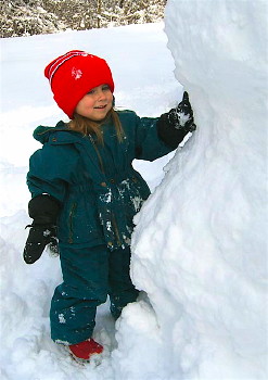
Indeed, the new snow was an excuse for the gang to help Abbey make a seven-foot-tall snowman, complete with cookies for eyes and raisins for his teeth.

The whole weekend was relaxing and enjoyed in the company of a dozen, easy-going, nature loving folks. Our friend Andy did an excellent job of reserving the cabin and making sure this event went smoothly. Even while he was visiting his family in Poland earlier this year, he was thinking of his hiking friends in Michigan. That was evident in the kindness he shared by bringing each of us a little 100ml bottle of one of Poland's finest treats for sipping by the campfire on a snowy, late December night.

Na zdrowie!

Monday, July 30, 2007

Birch Grove Trail

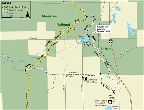
Earlier I wrote a few times about the Birch Grove Trail, a new hiking loop the Western Michigan Chapter of the NCTA has been building up near the Loda Lake Wildflower Sanctuary, north of White Cloud in the Manistee National Forest.

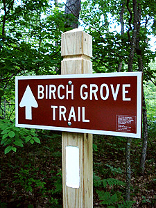
Well, the loop was officially opened on June 2 this year. The work is 99% done. We just have three signs to place, but they aren't essential if you have a map. Lucky for you, I've posted a link to a download-able, printable one here.

I'd highly recommend this loop for a summertime stroll. Besides, we need the feet to beat back the bracken ferns on this new trail. Sure, springtime is best for wildflowers and fall good for colors, but the shade of the woods can't be beat in summer.

If you're looking for other place in Michigan to take a summer stroll, check out Mike Ingels' blog. Mike's a history buff, a good writer, has an eye for the unique in the ordinary, and has summers off to do lots of blogging.

Wednesday, May 30, 2007

Pictured Rocks

Over the Memorial Day weekend, Julie, Abbey and I joined eight friends for a hike along the North Country Trail along Pictured Rocks National Lakeshore. The trail along Pictured Rocks is about 45 miles long and covers a wide variety of terrain.

We took the shuttle from Munising to Grand Marais on Friday morning and exited the bus to a hoard of black flies. Fortunately, that was the last we saw of those nasty creatures. We had purchased some Repel Lemon Eucalyptus insect repellent that worked wonders on black flies and did pretty good deterring mosquitoes too (although it needed somewhat frequent reapplications for the latter).

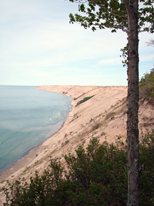
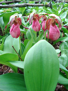
On the first day, we crossed behind the Grand Sable Dunes and enjoyed a wide variety of wildflowers and bird life. The forest floor was carpeted with spring wildflowers that had stopped blooming in Michigan's lower peninsula weeks before.

Fortunately I toted along my binoculars, but I regretfully left the bird book in the car. I also had now way to identify flowers, so I picked up a small Michigan guide when we past by a ranger station at noon.

By the end of the first day, we were camped near the Au Sable Light Station.

The second day was mostly beach hiking in the morning, then back into the woods for the afternoon. While we had about a dozen miles to hike, Julie, Abbey and I got started early and walked at a rather leisurely pace. When you hike with a three-year-old, you get plenty of time to stop and reference the field guide. You also get plenty of time to watch birds through your binoculars.

By that evening, the clouds had rolled in an we got a few sprinkles of rain around dinner hour.

The second half of the trip was a dramatic departure from the gentle beach and forest walking of the first two days.

Our family left camp at dawn and stopped on a bluff over looking Lake Superior for breakfast. As we we cleaning up, a frantic hiker passed us and said that he had just come from the next camp don the trail and that there was a black bear in the campground. We quickly packed up and headed onward to see if we could find he bear, but he was long gone by the time we got there.

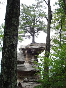
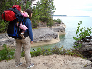
Later that morning, we started climbing into some rockier headlands. Now we were in the area for which the lake shore is known. Small cliffs gave way to higher and higher ones, and drama of the scenery became more intense. That night we camped at Mosquito Beach, which proved to be a misnomer.

The fourth and final day continued the climbs over rocky headlands. I filled my camera with images, too many to show all of them on this blog.

Bright sun, blue waters and woods full of colorful birds and flowers made for a beautiful walk.

By 2:00pm, we were exiting the woods. As we got near the road, Abbey surprised us all as she saw the car, then turned around and ran back into the woods crying. We quickly soothed her with promises of pizza and Phish Food.

The company was good, the weather cooperative, and Abbey successfully completed her first backpacking trip. It was a good walk and has filled my mind with memories.

Sunday, May 06, 2007

Spring Wildflowers

Julie, Abbey and I got out into the woods both yesterday and today. The extreme cold and extreme warm weather earlier this spring has lots of wildflowers blooming at the same time right now in Kent County.

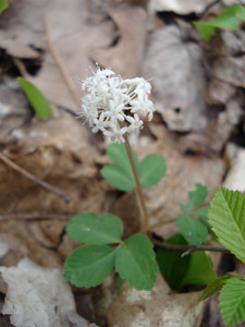
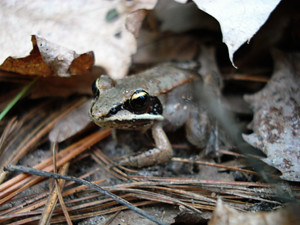
Yesterday we stopped by the Rogue River State Game Area in the late afternoon and I took this picture of a dwarf ginseng, trillium grandiflorum, and the peeking peeper.

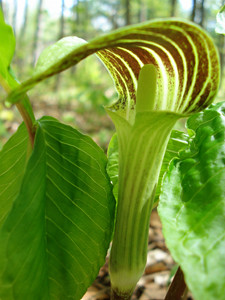
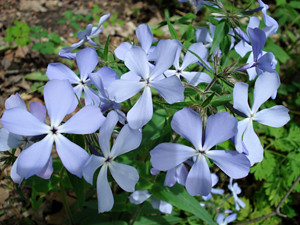
Today we took a short walk with some folks from church at Blandford Nature Center. There I snapped the pictures of the Jack in the pulpit and the woodland phlox.

If you live in west Michigan and like to take in the spring wildflowers, get out there quick!


Friday, March 02, 2007

First Things First

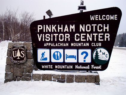
Looks like the folks at the Appalachian Mountain Club's facility in Pinkham Notch, New Hampshire have their priorities set straight. According to this sign, it's hike, eat, sleep, then ask questions.


Tuckerman Snowshoe & Lady's Lookout

While my Dad was busy with the chore of picking up pine cones after a spring storm rolled through North Carolina, I was happily playing in a foot of fresh snow laid down by that same storm in New Hampshire.

The morning was windy and very snowy, but by the time Abbey laid down for her afternoon nap, the wind had calmed and the snow had slowed down to a reasonable intensity for walking. I bundled up and strapped on my snowshoes with the intent of taking a short quarter-mile walk to Crystal Cascade.

As I started walking up the Tuckerman Ravine Trail, I realized that the path was nicely packed out below the foot of new powder and that the going was easy. The easy going quickly had me contemplating a longer walk.

When I got to Crystal Cascade, all ninety vertical feet of it were under snow and ice. It basically looked like a snowy hill. With that disappointment, my mind was made up that I would trudge on up the east slope of Mount Washington for another ninety minutes to see how far I would get.

By 3:30pm, I was standing at the foot of the lower headwall of Tuckerman Ravine and 1,850 feet higher than my starting point. While you can't see the dramatic headwall due to all the falling snow in the picture, this is the area on Mount Washington that is famous for springtime backcountry ski runs. Since the avalanche danger with the new snow was very high, no one was skiing the ravine. Instead, skiers and snowboarders headed down the John Sherburne Ski Trail.

Wearing snowshoes, I had to return back down the Tuckerman Ravine Trail. Heading downhill in a foot of powder definately goes much more quickly than going up. In fact, I arrived at the bottom within minutes of the snow boarders who left the ravine minutes after I did. They were surprised to see me at the bottom so quickly.

In all, it was a quiet 4.8 mile hike during which I saw only five other hikers and two on skis along the trail.

As I walked back to Joe Dodge Lodge, Julie and Abbey were coming out the door for a walk before dinner. We crossed the road and post holed through the deep snow for about a quarter mile to the Lady's Lookout.

Yeah, the name is a bit sexist and I know plenty of lady's that can hike further and higher than most men. Nonetheless, we enjoyed the short walk in the woods among the birch, spruce and fir and worked up an appetite for dinner.

Thursday, March 01, 2007

Hiking the Hight of the Whites

At long last I was able to return to the White Mountains of New Hampshire. Unlike last February, Thursday morning greeted me with crisp, clear blue skies. Having watched the weather reports the previous few days, I knew that Thursday would be my best chance for long views, so I set out at the crack of dawn to climb Mount Hight and Carter Dome. My hike would take me 10.2 miles and up and over 3,600 vertical feet.

I was at the trailhead by 7:00am in the five degree heat. The Nineteen Mile Brook Trail climbs gently at first up the western slope of the range, keeping me in the shadows most of the way to the summit. As I turned northeasterly on the Carter Done Trail, the Northern Presidential range gleamed in the morning light behind me.

The climb was fairly easy, as the trail was well packed out. Crampons stayed in the backpack, even on the exposed summit, and snowshoes were not donned until the deep snows in the col between Hight and Carter Dome.

On my way to the top of Mount Hight I didn't see another soul. At the summit, I took in the long views into Maine, and back towards Mount Washington. As I snapped pictures that can do no justice, two other hikers arrived at the summit.

The snow between Hight and Carter on the Carter-Moriah Trail was deep. To make matters worse, some unfortunate snowshoeless person and a wayward moose had both punched holes into the deep snow along the pathway, making the hiking a bit tedious.

But the bright, warm sun and the incredible alpine scene took my mind off of the hard work.

At the summit of Carter Dome I ran into Wes who had hiked up from the AMC hut at Carter Notch. We traded a few snapshots and shared our amazement at the strong warming power of the sun and the complete lack of wind.
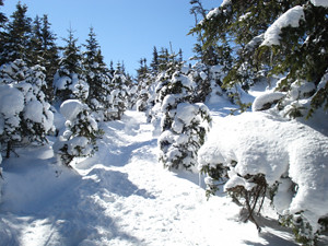
From there, I descended the steep trail into Carter Notch, explored the frozen lakes, and checked in at the hut. The hut was filled with a dozen high schoolers. I wondered about why they ate lunch in the cold, dark hut while there was such a bright, beautiful, dramatic landscape outside. I guess years of eating lunch inside at the table had prompted them to be creatures of habit rather than patrons of the outdoor aesthetic.

From the hut, I climbed a steep pitch, then descended down the Nineteen Mile Brook Trail back to my car. It felt good to be walking downhill for a change.

Tuesday, January 30, 2007

Mount Washington

Here's my first summit of Mount Washington. I'm the one to the left pounding the rocks.

To my right are my brother Bill, sister Beth, and brother Rich.

Admittedly, we drove the first 6,280 feet up in the back of a green and tan 1960's VW microbus with a canvas sunroof. We had the bumper sticker to prove it!

In another four weeks, Julie and Abbey and I will be vacationing at the bottom of Mount Washington at Joe Dodge Lodge in Pinkham Notch. I'll be climbing some less exposed peaks during that visit.
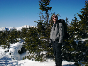
Saturday, January 13, 2007

Run

One of the things I think I like best about the winter months is the slower pace of weekends, particularly Saturdays. In the spring, there is tons of trail work and gardening to do. When summer hits, the gardening is still heavy through the end of July, and home repairs need doing. Summer is also a good time to get the cars in tip-top shape. Then fall brings more trail work and getting things buttoned up for winter.

With our unusually mild winter, Saturdays have been good for getting in long urban hikes and some trail running. Today I was able to get out to the North Country Trail in the Lowell State Game Area for a nice six mile run.

Before and after I walked a little more than a half mile for warm-up and cool-down. All together, I travelled a little more than seven miles of trail and I didn't see a soul the whole time. The woods were peaceful, with a few chattering birds to keep me company (chickadees, juncos and blue jays).

The NCT in Lowell is a nice run. Most of the trail has good footing, and there are a few short but steep hills to build up a little leg muscle (and keep Siler from day dreaming too much). I've seen other runners out there when hiking in the past, so it appears I'm not the only one who likes to run there.

A nice PDF map of the Lowell NCTA can be downloaded here.

Sunday, December 03, 2006

First Ski of the Year

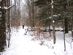
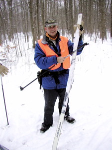
chuckski3Right on cue, December brought the first good snow to west Michigan. The cold air that moved in today brought a few more inches and lots of gracefully floating flakes in the air. Feeling the need for some exercise, I called my friend Chuck to see if he would be interested in a quick ski in the Rogue River State Game Area in northern Kent County.

As luck would have it, Chuck was home and he had the spare time on his hands.

There was just enough snow on the ground for skiing, although the snow closest to the ground was still plenty moist from last week's heavy rains and temperatures in the 60s. But more on that later.

judytreeAfter skiing for about twenty minutes, we came to one of my favorite bluffs over the Rogue River, a place that I jokingly refer to as the "Judy Tree." Since it was quite a while since I had last visited this section of trail, I was surprised to find that the Judy Tree had been toppled in a storm.

As she fell, she split into pieces. The big trunk of this 100 year-old beech fell towards the river, another branch fell to the north, and a twisted mess of branches fell across the trail.

judyWhy do I call her the "Judy Tree?"

Many years ago, when she was still standing and healthy, plenty a jack knife plied her trunk to claim that various unthoughtful souls had passed her way. One particular person that apparently passed her way more than once was Judy. By the evidence on the trunk, Judy had a number of male suitors that felt in necessary to proclaim their love in the smooth bark of this beautiful beech. On the tree could be read "Dave + Judy"... and Mike, and Ron, and Joe...
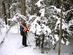
While Judy was certainly loved, the lack of affection that many a passer by had for the tree eventually lead to its ill health and demise.

The ironic thing was that while it lived, the Judy Tree tightly embraced a neighboring hemlock, leaving a huge scar that can be seen to this day.

chuckski2Chuck and I skied north for a bit more than two miles before turning around. At the turn-around point, we shared a power bar and Chuck dug out a few shelled chestnuts he had purchased from a farmer in Newaygo County.

During our break, we talked about how we hoped that our tracks would cause the snow to freeze a little more firmly.

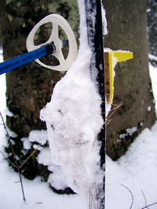
That was not to be the case. Instead, the wet snow underneath continued to stick to our skis, causing us to have to stop and scrape off the frozen slush.
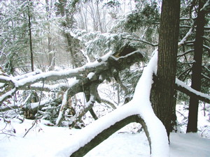
chuckski1The stuff got so dreadful at times that we could hardly push our skis along. It caused us to wobble and strain.
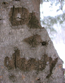
To the right is a picture of the frozen mass found underneath one of my skis, pine needles and all.

The friction made the skiing hard work. I thought it odd how we were now basically walking through the woods with six foot long and two inch wide snowshoes shaped like elves' booties.

blobYet all the work still didn't keep us from enjoying the wonderful beauty of the newly fallen snow and the flakes drifting around us. Whether we skied past beeches, birch, oaks or hemlocks, the whiteness of the new snow was refreshing.

The beauty and the work made for a nice afternoon, and as we skied back to the Jeep shortly after 5:00pm, the clouds thinned enough to give us a glimpse of the rising full moon.

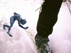
And the moonlight allowed me to snap one quick last picture of this little troll snatching at my ski! And all along I thought it was the wet snow.

trollski